

3D Capture
Every digital twin starts with a scan. A physical space, indoors or outdoors, is measured and recorded in three dimensions, producing a point cloud, a mesh, or a fully navigable digital model. The right approach depends on the environment and what you need.
We match technology to outcome, not the other way around
Most vendors sell a device first, then find a use for it. We assess your site, your outcome, and your budget, then recommend the capture method that actually fits.
Indoor Capture +
Speed, repeatability, and ease of navigation. Ideal for portfolio-wide digital twins, facilities management, retail and office environments, and interior condition documentation.
Outdoor & Large-Scale +
Longer range, higher tolerance for light and weather. Covers façades, roofs, infrastructure corridors, and industrial sites where tripod scanners or drones excel.
Close-Range & Detail +
Millimetre and sub-millimetre accuracy. Covers small mechanical parts, forensic documentation, and heritage detail where precision matters more than speed.
Internal Mapping
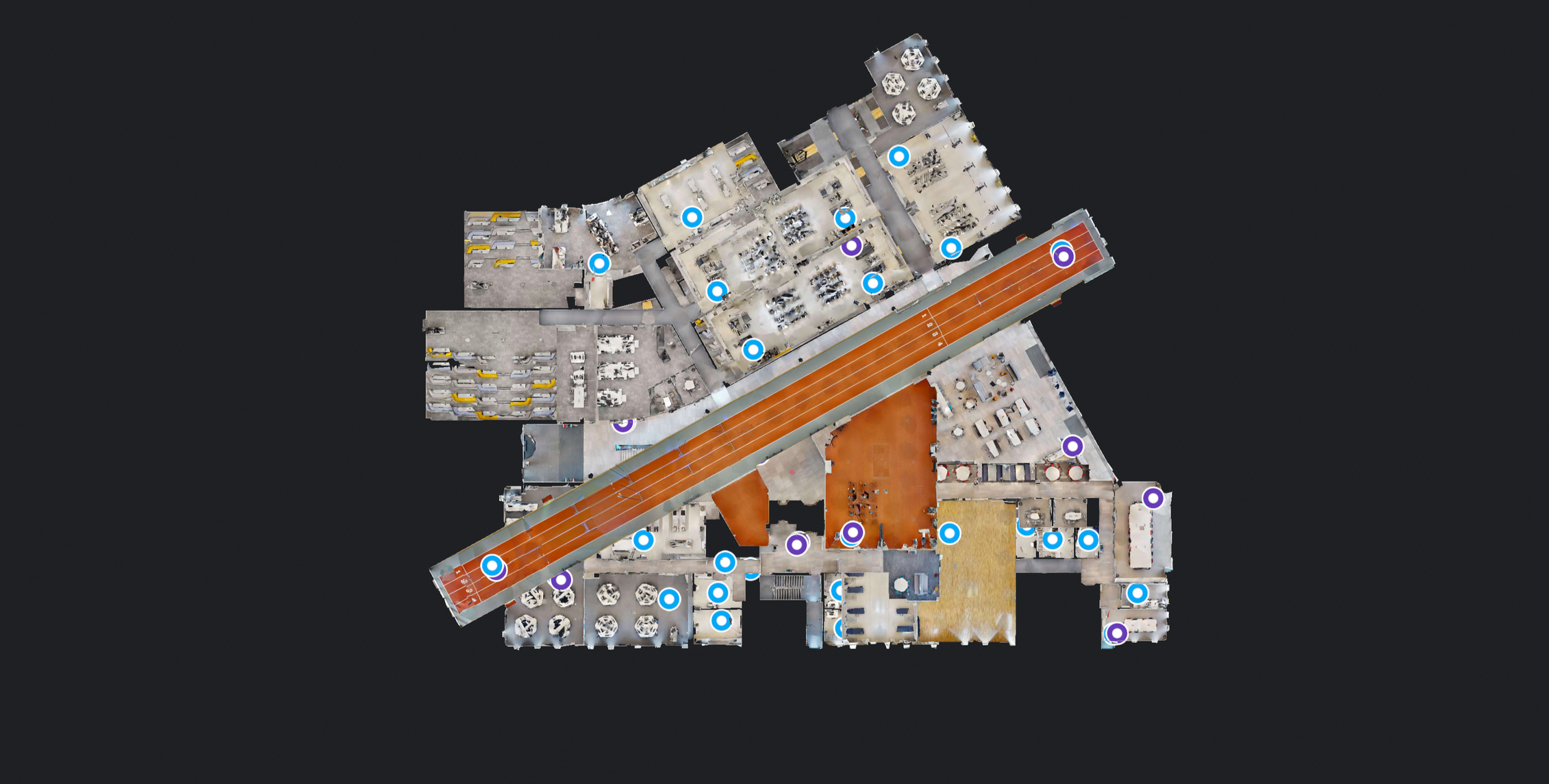
We use professional-grade LiDAR-equipped cameras to walk every internal space of your building, capturing a continuous, fully navigable 3D model. Every room, corridor, plant room, riser, and roof void is explicitly documented.
What gets captured- All internal spaces including plant rooms, risers, and service areas
- Accurate room dimensions and spatial relationships
- Visual structural detail at sharp 4K resolution
- Tagged interactive locations for assets, defects, or points of interest
Drone Powered Capture
For building exteriors, roofs, facades, and hard-to-access elevations, we deploy specialist drone technology operated by a CAA-qualified pilot. Our fleet uses high-resolution RGB imaging combined with LiDAR scanning to produce a fully textured 3D model of your building's exterior with zero scaffolding, zero access equipment, and no disruption to occupants.
Particularly valuable for- Facade condition assessments and defect identification
- Roof surveys and comprehensive drainage inspections
- Pre-purchase, structural validation, or pre-refurbishment site surveys
- Large or highly complex sites where ground-level access is completely impractical
Why We Don't Sell One Platform
Most providers in this space sell a device, then find you a use for it. We work the other way round.
Twinflow is technology-agnostic. We assess the site, the outcome, and the budget first, then recommend, source, and manage the capture technology that actually fits, whether that's a single Matterport sweep or a multi-device programme spanning wearable LiDAR, tripod scanning, and drone-based thermal inspection.
No Pressure
No recommendation toward a device that doesn't fit the job. Your outcome comes first.
Direct Relationships
We work directly with manufacturers and specialists behind each technology, so you get expert sourcing, not middleman markup.
One Point of Contact
We manage the right mix of technologies coordinated as one deliverable, instead of you evaluating five vendors separately.
The Technology We Work With
This list expands as we onboard new capture partners. Scroll to explore.
Compare The Technology in Detail
Matterport Pro3
Fast, repeatable capture with extended range and outdoor capability.
Leica RTC360
Survey-grade accuracy for construction and MEP clash detection.
FARO Focus Premium
Long-range precision for large infrastructure and outdoor sites.
Matterport Pro2
Budget-friendly, indoor-only capture for simple projects.
Leica BLK360 G2
Compact dome scanner for smaller sites and real estate.
FARO Focus Core
Mid-range industrial scanning for facilities and sites.
NavVis VLX 3
Premium wearable SLAM for large-scale building documentation.
Leica BLK2GO
Handheld mobile mapping for large open facilities.
FARO Orbis
Hybrid mobile mapping for hazardous environments.
DJI M350 + P1
Photogrammetry platform for large-scale aerial mapping.
DJI M350 + L2
LiDAR point clouds for terrain and vegetation mapping.
DJI M350 + H30T
Thermal imaging with night capability for critical infrastructure.
FARO Freestyle 2
Handheld structured-light scanning for millimetre-level detail.
Every model we deliver comes with the following built-in capabilities as standard.
Immersive 3D Walkthrough
Navigate your building in full 360-degree photorealism from any web browser. Share a link with anyone — no app, no login, no friction.
Accurate Measurements
Take precise point-to-point measurements directly within the model. Room dimensions, ceiling heights, corridor widths — all measurable without stepping foot on site.
Schematic Floor Plans
AI-generated floor plans are produced automatically from the scan data and exported as PDF, PNG, or SVG. Accurate enough for space planning and lease documentation.
Tagging and Annotation
Add tags, notes, images, documents, and hyperlinks to specific locations within the model. Useful for asset registers, maintenance records, defect logs, and compliance documentation.
Information Hotspots
Embed rich content directly into the 3D space — PDF datasheets, maintenance instructions, warranties, or inspection records — anchored to the exact location they relate to.
Multi-Floor Navigation
Break away from unorganized files. Transition smoothly across vertical building tiers, complex engineering plant elevations, or distinct mezzanine spaces within a single dashboard layer.
Guided Tours
Automate your project walks. Direct facility engineers, handover stakeholders, or prospective tenants along pre-recorded key path strings to highlight structural modifications or core spatial values.
Shareable & Embeddable
Distribute links globally. Drop your spatial twins natively inside construction administration hubs, operational asset boards, or client presentation pages using lightweight frames.
Privacy Masking
Enforce data boundary compliance. Leverage blurring profiles to dynamically obscure facial visibility, personal identification labels, or proprietary asset specifications before models go public.
Mobile Compatible
Interrogate your assets anywhere. Experience optimized frame delivery and uncompromised responsive cloud handling across all tablet devices and physical smartphone interfaces on site.
Our four-stage delivery model
Assess project requirements and define the scope of your digital twin implementation. We identify key objectives, evaluate technical feasibility, and establish success criteria to ensure alignment with your business goals.
Capture accurate spatial data using advanced scanning technologies. We collect comprehensive 3D measurements and visual information of your physical assets to create the foundation for your digital twin.
Build and configure your digital twin environment with processed data. We establish the digital infrastructure, integrate captured information, and set up management systems for ongoing oversight and control.
Connect your digital twin with existing systems and workflows. We enable seamless data exchange, automate routine processes, and create intelligent connections that maximize operational efficiency and insights.
Not Sure Which Fits Your Project?
Most sites need more than one. A single portfolio might combine wearable mobile mapping for large floorplates, tripod scanning for detail-critical rooms, and drone thermal inspection for the roof, all coordinated as one deliverable.