01 / Sectors   Design & Construction - Architecture, Engineering & Construction

Every milestone. Every layer. Every asset. True as-built control.

Twinflow deploys high-fidelity spatial digital twin technology across the complete construction lifecycle, from existing-conditions surveys to final practical handover. A photorealistic, millimetre-accurate, navigable 3D database. Centralised. Verifiable. Integrated.

02 / The challenge AEC Delivery Risks

Multi-million-pound programmes, managed with fragments of reality.

Construction projects are getting bigger, faster, and more complex. Yet teams still rely on static 2D drawings, fragmented email chains, and manual inspections to track work. The inevitable outcome is costly rework, missed defects, and disputes over what was built and when.

5-15%
of total project costs globally are consumed directly by structural and system rework
25%
of all construction delays are triggered by disputes over unverified as-built site conditions
52%
of site rework is caused entirely by poor project data and team miscommunication
40%
reduction in initial survey costs achieved versus traditional manual measured survey methods
10-100x
cost multiplier to resolve an error on site versus catching it at design stage via clash detection
50%
reduction in non-productive site travel for consultants through remote visual access
03 / What it does One platform, complete lifecycle visibility

A photorealistic, navigable 3D record of your project at every milestone.

Every structural bay, concealed MEP route, and finishes layer. Captured with professional-grade LiDAR, accurate to within millimetres, and live in the cloud within 24 to 48 hours. Navigable by your architects, engineers, and clients from any device, anywhere.

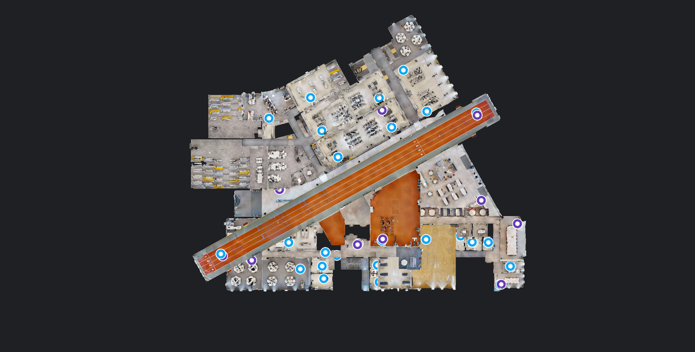
Interactive twin · Construction Site · Sunnyvale, CA, USA
04 / Use cases Six ways AEC teams use Twinflow

Engineered for the reality of high-value project delivery.

01
Pre-con & existing conditions

Complete, interactive spatial baselines from day one without repeat site visits.

02
Design & clash detection

Validate BIM design assumptions against reality before committing to physical site builds.

03
Progress monitoring

Timestamped milestone tracking and remote virtual walks for off-site stakeholders.

04
Quality control (QA/QC)

Spatially link snag logs and issues directly within the 3D grid model for contractors.

05
BIM & CAD integration

Direct point-cloud exports to Revit and Navisworks, bypassing manual trace workflows.

06
Handover & O&M twins

A navigable, visual operations library connecting assets directly to documentation tabs.

01 Pre-construction & existing conditions capture

Before a single line is drawn, you need to know exactly what you are working with. Traditional measured surveys are expensive, slow, and rarely capture the full visual and mechanical baseline. Vague parameters lead to design assumptions that fail during construction.

A Twinflow scan of an existing structure or complex asset envelope gives your design team a complete, accurate 3D record they can interrogate remotely at any point in the project—without ever returning to site. Every space is measurable. Floor-to-ceiling heights, column structures, and plant room layouts are accessible instantly without a physical tape measure.

In practice

  • Eliminate repeat site travel for engineering information and dimensions gathering
  • Give architects and engineers remote access to precise spatial files from day one
  • Spot structural constraints and layout liabilities before they become site challenges
  • Establish an undisputed, legally secure baseline record of asset handover states
Impact · Reduce survey costs by up to 40% versus traditional measured survey methods
02 Design development & clash detection

Great design requires absolute spatial tracking. Digital twins give your engineering team a navigable reference model they can return to throughout the design process—checking layout changes, verifying clearance dimensions, and checking proposals against structural reality.

When integrated with structural modeling tools, Twinflow scans can be used to validate model accuracy against actual conditions, catching coordination errors across service structures long before they impact field build progress.

In practice

  • Overlay point cloud data with BIM models to identify clashes between services and concrete structure
  • Validate existing ceiling heights, structural bays, and beam positions before finalizing routing designs
  • Provide accurate floorplate files for retrofit and refurbishment projects where historical prints are lost
  • Support planning submissions with interactive, photorealistic context environments
Impact · Clash resolution at design costs 10–100x less than errors caught mid-build on site
03 Construction progress monitoring

Once construction begins, tracking field compliance and verifying schedule execution is a full-time liability. Twinflow implements a system of recurring 3D scans at agreed milestones, producing a timestamped, navigable visual database of the construction lifecycle.

Project managers, investment clients, and remote engineers can walk the floor virtually at any time, checking work against blueprints. Document concealed installations, such as MEP routing, underfloor paths, and structural fixings, before they are buried behind finishes layers—retaining a permanent record critical for insurance, future refits, and asset operations.

In practice

  • Deliver periodic progress scans to streamline remote client transparency and project reporting
  • Maintain a permanent visual trail to support interim validation, billing, and sign-offs
  • Review hidden mechanics and insulation runs before walls and partitions are permanently sealed
  • Enable cross-functional coordination loops between off-site consultants and field supervisors
Impact · Cut non-productive site visits by up to 50% for off-site consultants and managers
04 Quality assurance & quality control (QA/QC)

Defects discovered late during site execution trigger heavy rework costs and knock-on program delays. Twinflow introduces precision location-linked QA/QC data flows directly within the navigable 3D environment.

Field supervisors pin snag issues, discrepancies, and defects directly to their exact grid coordinate inside the twin. Instead of interpreting vague tracking sheets like "level two, corridor near eastern staircase," contractors can load the precise spatial view, look directly at the problem asset, and close out the fix efficiently.

In practice

  • Drive structural defect tracking and localized snag logging inside a navigable 3D model
  • Tag photo markers and engineering notes to coordinates for clear trade coordination
  • Manage remote pre-handover walks with clients to evaluate tolerances and finish qualities
  • Retain permanent, timestamped evidence of built conditions at practical completion to limit liability
Impact · Identify design deviations up to 2–3 weeks earlier than standard inspections
05 BIM & CAD integration

Digital twins deliver maximum value when they communicate seamlessly with the technical tools your project teams run daily. Twinflow models integrate with top industry architecture platforms—including Autodesk Revit, Navisworks, AutoCAD, and Procore.

This allows teams to push authentic 3D site context directly into design and tracking workflows without platform jumping. Export accurate point cloud data, floor prints, and dimensioned geometric profiles directly from the model, dramatically cutting down the engineering hours spent redrawing field data.

In practice

  • Generate point cloud meshes directly from site scans to accelerate BIM asset development
  • Export dimensioned floor configurations and cross-sections into standard CAD engines
  • Embed contextual digital twins into project tracking hubs like Procore for instant lookup
  • Feed validated spatial measurements directly into asset tables during project handovers
Impact · Reduce asset modeling time from existing site drawings by up to 60%
06 As-built documentation & project handover

Handover documents at project completion are frequently incomplete or difficult to navigate. Flat PDFs, unorganized file packages, and printed manuals fail to show engineers where valves hide or how conduits run behind ceiling partitions.

A Twinflow asset handover package provides operations, engineering, and facilities management teams with an interactive 3D model. Link operations manuals, structural specifications, product tags, and component histories directly to spatial assets. It transforms standard documents into a responsive visual dashboard for the long-term lifecycle of the asset.

In practice

  • Deliver a navigable as-built spatial database as a core asset handover document
  • Link equipment datasheets, maintenance instructions, and warranties directly to assets
  • Equip facility engineers with an intuitive visual system on day one of occupation
  • Establish an authenticated baseline file for subsequent upgrades, tracking, and plant operations
Impact · Protect critical built data from being lost within 12 months of site handover
05 / How it works From mobilization to asset handover

A five-stage integration model built around complex site lifecycles.

STAGE 01
Project scope & milestone planning

We audit your architectural intents, site parameters, and project timeline. We formalize survey frequencies tailored to your key structural milestones, establishing required spatial tolerances and coordinate benchmarks across project management, design, and engineering functions.

STAGE 02
High-precision field capture

Our surveyors deploy professional-grade LiDAR and photogrammetry arrays directly on site. Data collection is systematically phased around site shifts and critical trade progress handovers to ensure continuous coverage without adding friction to active construction operations.

STAGE 03
Processing & cloud publishing

Raw scan spatial models are compiled, calibrated, and published to our secure web platform within 24 to 48 hours. The twin is geo-referenced to site datums and structured into layout levels with role-defined access, putting survey data into the hands of stakeholders rapidly.

STAGE 04
BIM & CDE system integration

We connect the twin repository with your Common Data Environment (CDE) and project tracking tech stacks—including Procore, Autodesk Construction Cloud, and Revit models—allowing point-clouds and 3D snags to map directly into current construction workflows.

STAGE 05
Milestone tracking & lifecycle update

As work moves through mechanical installations and finishes layers, recurring scans capture site updates. This generates an unalterable, delta-tracked history of concealed structures, leading directly to a data-rich, navigable as-built asset package for handover.

06 / ROI Measurable impact across the project lifecycle

The business case for digital twins in construction.

10-100x
Cost avoidance per error by catching design clashes pre-construction versus on-site
40%
Reduction in manual surveying and site-travel costs across the design phase
50%
Reduction in non-productive site travel for remote consultants and engineers
30%
Average reduction in dispute resolution costs through factual as-built visual records

For high-value capital programmes, Twinflow represents a minimal fraction of the total project expenditure, while directly mitigating the costly rework and data-misalignment risks that typically consume 10% to 15% of total construction budgets.

07 / Sub-sectors Twinflow applications across AEC project types

Engineered for the complexities of the built environment.

Commercial office

Category A/B fit-out coordination, base-build surveying, and tenant handover documentation.

Infrastructure & utilities

Complex MEP routing verification, plant room condition monitoring, and safety-critical asset tracking.

Residential development

High-volume unit QA/QC, progress monitoring for multi-story builds, and defect snagging.

Industrial & logistics

Large-format structural envelope capture, rack coordination, and clear-height validation.

Education & healthcare

Stringent regulatory compliance records, sterile-area access documentation, and life-cycle asset management.

Heritage & adaptive reuse

High-detail geometric capture for restoration, structural movement tracking, and irregular form documentation.

Mixed-use masterplanning

Stakeholder transparency, large-site progress sequencing, and long-term site operations management.

08 / Who we work with Supporting AEC stakeholders

Built for every team responsible for high-precision site delivery.

Architects & designers

Existing condition baselines, site context capture, BIM coordination.

Construction project managers

Milestone tracking, program compliance, remote site reporting.

MEP & structural engineers

Clash detection, service routing validation, structural assessment.

Clients & asset owners

Investment transparency, project sign-off, O&M handover.

Facilities management teams

Asset register management, maintenance planning, as-built records.

BIM & digital leads

Point-cloud integration, CDE workflows, data standardisation.

Heritage & conservationists

Structural movement tracking, restoration documentation, legacy preservation.

09 / Talk to us

Precision at every phase. Deliver your projects with absolute spatial certainty.

Stop guessing the state of your site. Twinflow provides the high-fidelity spatial data you need to eliminate rework, improve design coordination, and guarantee seamless project handover.