

The digital twin of your physical world.
Spatial intelligence for the built environment. Photorealistic, millimetre-accurate 3D twins of every asset, space, and site. Captured, navigable, and always current. Founded by a former enterprise specialist at one of the world's leading 3D capture platforms — with over a decade of experience across technology that compliments the Built World — Twinflow helps organisations navigate the digital twin landscape without being locked into a single vendor's ecosystem.
Most organisations can't see their physical estate accurately enough to manage it.
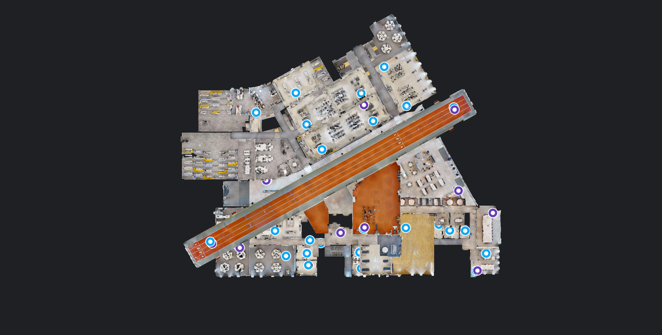
Twinflow turns physical buildings, sites, and assets into living digital twins. One platform across every location, accessible to every team. From capture through to integration with your existing systems.
From capture to operations, end-to-end.
Engage any service individually, or as a complete digital twin programme.
Industry-leading 3D camera technology creates photorealistic twins with millimetre accuracy of interior spaces and external facades. Every defect and risk documented.
Learn more →We host your 3D model, accessible from anywhere, without a contracted software subscription. Free hosting to test your twin and confirm ROI before purchase.
Learn more →CAA-licensed pilots deliver safe, efficient 3D mapping and external surveys. Capture areas inaccessible by traditional methods, validated by engineers.
Learn more →Architecture-ready BIM, CAD, Revit or point cloud files for updating building data and developing advanced opportunities. Perfect for designers, fire strategy, FM.
Learn more →Tag and track every asset, connect building systems and live intelligence. Link with remote IoT devices and software for a golden-thread 3D asset management reference.
Learn more →Every space, every challenge, engineered differently.
Each sector has its own definition of accurate documentation. Twinflow is configured for each one. Scroll to explore where Twinflow works in both operational and promotional sectors.
Existing-conditions surveys, as-builts, and BIM-ready data.
View sector →Documentation, maintenance, and compliance across complex portfolios.
View sector →Marketing tours, due diligence, and leasing documentation.
View sector →Plant documentation, asset tracking, and reconfiguration planning.
View sector →Compliance-grade documentation for regulated assets.
View sector →Digital mapping for critical infrastructure and rack management.
View sector →Brand compliance, refit planning, and lease dilapidations.
View sector →Golden Thread compliance, FRA hosting, and strategy support.
View sector →High-fidelity virtual experiences to captivate buyers and tenants.
View sector →Reception visualisation, ceremony preview, and event capability showcase.
View sector →Dining room ambiance, kitchen showcase, and reservation confidence.
View sector →Atmosphere and entertainment preview, dance floor and bar context.
View sector →Room variety showcase, amenity tours, and booking confidence.
View sector →Equipment showcase, facility tours, and class environment visualisation.
View sector →Auditorium tours, screen previews, and premium seating showcase.
View sector →Exhibition tours, collection context, and visitor journey wayfinding.
View sector →Product display, store layout tours, and customer navigation context.
View sector →Showroom tours, vehicle context, and customer confidence building.
View sector →Built around the realities of live, operational estates.
From scan to published twin in two working days. No long implementation, no IT overhaul, no software subscription burden.
Not a CAD model. Not an approximation. The space as it actually is, measurable to within millimetres, navigable from anywhere.
CMMS, EAM, BIM, CAD, GIS, IoT. Spatial context flows through the tools your teams already use.
Free hosting available to test your twin and confirm ROI before committing to a programme.
Our four-stage delivery model
Assess project requirements and define the scope of your digital twin implementation. We identify key objectives, evaluate technical feasibility, and establish success criteria to ensure alignment with your business goals.
Capture accurate spatial data using advanced scanning technologies. We collect comprehensive 3D measurements and visual information of your physical assets to create the foundation for your digital twin.
Build and configure your digital twin environment with processed data. We establish the digital infrastructure, integrate captured information, and set up management systems for ongoing oversight and control.
Connect your digital twin with existing systems and workflows. We enable seamless data exchange, automate routine processes, and create intelligent connections that maximize operational efficiency and insights.
Spatial intelligence for the built world. Built for what you actully manage.
Get in touch for a no-obligation quote. We cover the whole of the UK/ EU and can typically mobilise within two weeks of instruction.